I don’t know about you, but I’ve always loved maps in fiction. Whether it’s a fantasy map of another realm, like in Lord of the Rings, or a unique-to-the-story map of a real world place, they’re among my favorite things.
Maps are a way to add a layer of reality to a story, to bring it to life in a more visual way. And even though I’m a writer, I’m a super visual person. So no wonder I love maps so much!
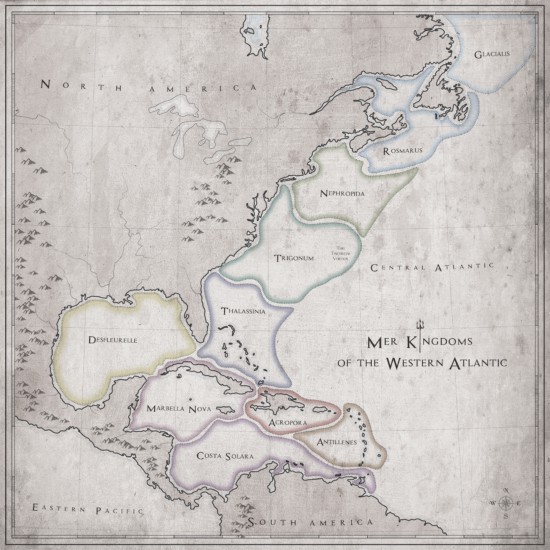
Which pretty much explains why I commissioned this beautiful map for my Forgive My Fins series.

The map shows all of the mer kingdoms in the Western Atlantic, the underwater equivalent of a continent. You can see Thalassinia, Princess Lily’s home, as well as all of the kingdoms she visits in Just For Fins. Everything from Costa Solara off the coast of South America to frigid Glacialis in the icy waters off of Canada.
Which kingdom would you want to live in?
Download a printable PDF version of the mer map.
If you want to read more about the kingdoms in this map, check out the Forgive My Fins series. And let me know which of my other series or worlds you want to see mapped out.
Please continue Lily and Quince’s story!
I plan to, Nicole! Someday… I just have to fit it in the schedule… Sign up for my free email list (teralynnchilds.com/subscribe) to get notified whenever there’s news!